The Narrow Passage~ By the sea on the west and by the sea on the east. ~by Don R. Hender The 'Narrow Pass' of the Book of Mormon is housed by the small or narrow neck of land which connects the Land Northward to the Land Southward. It is most frequently thought of as a mountain pass. But is it? The Book of Mormon never says that it is a mountain pass. In fact in the only verse that attempts any description of the pass is most confusing. It states, "… by the sea, on the west and on the east." Now how can one 'narrow pass' be by both the east sea and the west sea when it is "… a day and a half's journey for a Nephite, …" wide? That is quite a wide narrow pass or an awfully lazy Nephite. Even the known scholar John L. Sorenson of F.A.R.M.S. on page 303 of 'The Geography of the Book of Mormon Events: A Source Book,' concludes that the one and only 'narrow pass' lay in the borders by the east shore. He then refers indirectly, without addressing it directly, back to Alma 50:34 by stating, '… regardless of whatever might be meant by "on the west" in 50:34.' John also makes a natural assumption that the 'narrow pass' is a mountainous type pass whether it be a gorge, canyon, or whatever. Yet I have come across another perspective in my research. And it gives meaning to Alma 50:34 when it says, "… by the sea, on the west and on the east". Now even John L. Sorenson understands that Mormon, on his retreat from the land of Zarahemla went by way of the Land of Joshua, which was by the borders west by the seashore. Now why didn't Mormon retreat to the 'narrow pass' on the east by the sea there? Why did he retreat by the western seashore and make his way into the land northward there? I've never been to MesoAmerica where John L. Sorenson supports all the stated lands of the Book of Mormon to primarily be. As accessible as they are today, I still can't afford that. I've never been to Colombia, Panama, or the Isthmus of Darien where the Prophet Joseph Smith says that Lehi landed a little south of. As inaccessible and dangerous as those locations are, I still can't afford them. But I have been on a mission for the Church to New Zealand. And what does that have to do with the 'narrow pass?' 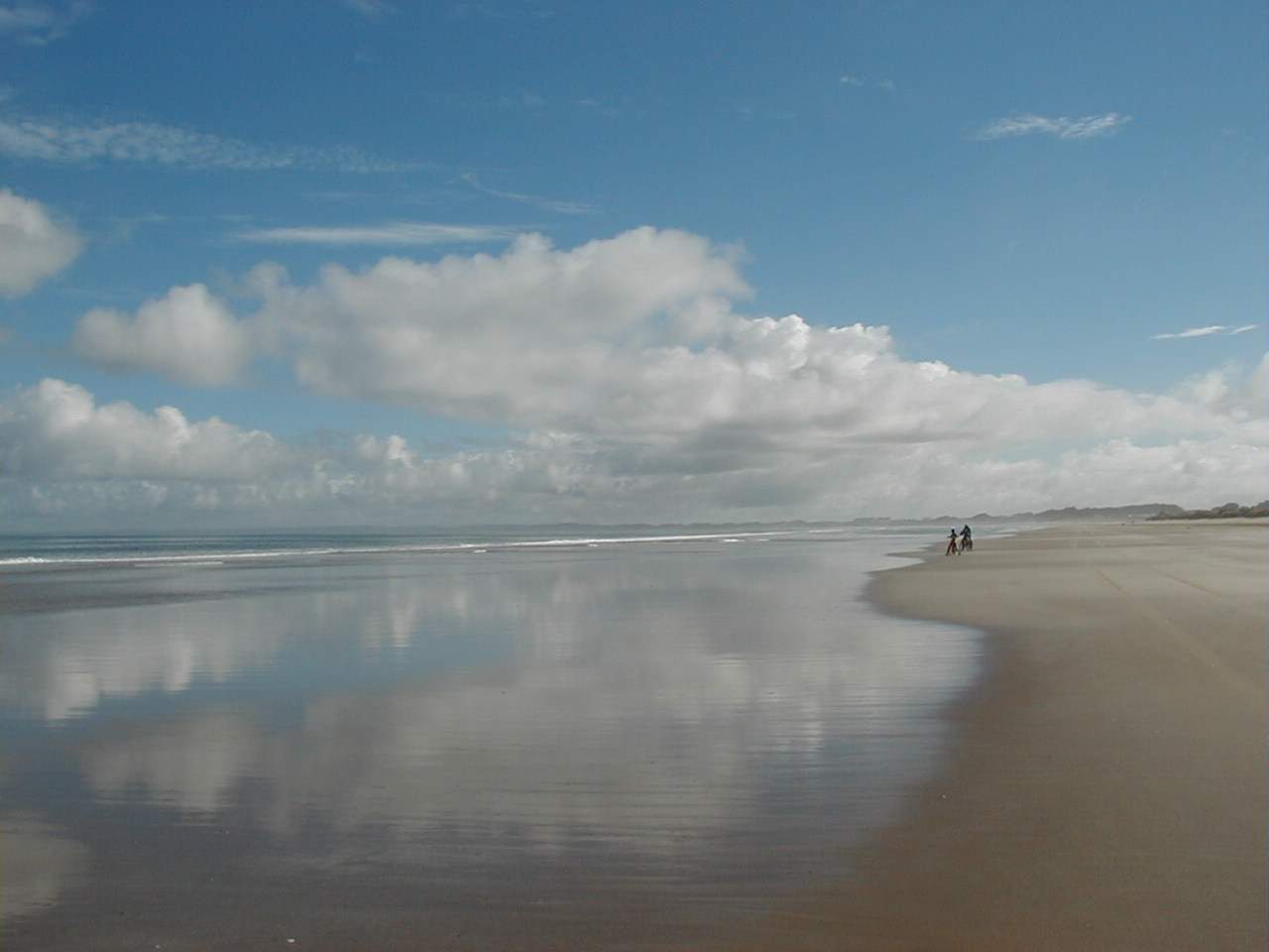 In New Zealand, in my first
area of Kaitaia I learned that a 'narrow pass' does not have to be a mountain pass. Kaitaia
was as far north as they stationed missionaries in the New Zealand North Mission but it wasn't
all the way to the top of the North Island. That was Cape Reinga or there about. Now there was
actually two ways to get to Cape Reinga. You could either take the 'inland' route away from the
sea on a winding, dusty, hilly, dirty, one lane road or you could take the 'super highway' along
Ninety Mile Beach. Actually it wasn't a super highway, but it was wider and smoother than one,
at least at low tide. It was here that I learned that a road or passage to somewhere didn't have
to go over hill or dell. It didn't even have to be a real road. In New Zealand, in my first
area of Kaitaia I learned that a 'narrow pass' does not have to be a mountain pass. Kaitaia
was as far north as they stationed missionaries in the New Zealand North Mission but it wasn't
all the way to the top of the North Island. That was Cape Reinga or there about. Now there was
actually two ways to get to Cape Reinga. You could either take the 'inland' route away from the
sea on a winding, dusty, hilly, dirty, one lane road or you could take the 'super highway' along
Ninety Mile Beach. Actually it wasn't a super highway, but it was wider and smoother than one,
at least at low tide. It was here that I learned that a road or passage to somewhere didn't have
to go over hill or dell. It didn't even have to be a real road.
Listen to what Professor Gerardo Reichel-Dolmatoff, born is Austria, of the Department of Anthropology at the University of los Andes, Bogota has to say in his book entitled Colombia. The Professor refers to the Darien as the 'narrow pathway' used by the first men to cross over between the land northward and the land southward. And though being an Anthropologist and prone to the scientific view, he has his dating wrong when compared the scriptural timetable. Of course the Jaredites did use this avenue, but as for Lehi and I would even speculate Mulek's party, both sailed their way to the Land Southward. Mulek would have after first landing on the land north. Concerning today's inland passage between Colombia and Panama, Professor Reichel-Dolmatoff makes the following statement about the interior of the Darien regions. "… this jungle-covered wilderness is considered by many to be an almost impassable obstacle to human migrations and its rain-forests, swamps, and dense underbrush are thought to form an impenetrable barrier." (page 42) He then refers to plentiful literature that describes it as a 'Green Hell.' I contemplate, that despite the bounteous harvest that Lehi produced at his landing site, the rain-forests presented just such a picture. To them it would be a 'Green Hell' full of wild beast of every kind, as they began to journey through it to a land along the western coast of Peru which would be more like the homeland they left. Yet the Professor further points out that the 'interior' route is not the route taken by the native Indians. kHe states, 'There is a dry season from January to March when the rains diminish greatly. At low tide one can walk for kilometers (miles) along the sand beaches, and (even) on the Pacific coast between Colombia and Panama, there are no mangrove swamps at all." (page 44) Now there are two reasons why the Lamanites attempted the eastern route. The first is their alliance with the Zoramites of the land that defected to the Lamanites of Antionum. This is what made the route shorter and more accessible, as the Lamanites had a 'jumping off' point in the land of the Zoramites which they did not have on the west coast. Second, the rivers, swamps and mangrove marshes of the west coast are as nearly as impenetrable, if not more so, than the interior of the Narrow Neck was. The only three routes to the Narrow Neck that where really feasible for travel would be the Cauca River valley which Limhi's adventures took in their early search for Zarahemla by mistake and which Lehi's party likely took from their landing site south to the land of first inheridance. And second, the main central route though the valley of Sidon or the Magdalena, and of course third the eastern route over the plains of Nephihah (western Orinoco Plains then above the water of the east sea) and its eastern sea coast where Moroni built his cities of defense all along the great Amazon sea east of that day. The opportunistic Lamanites, confederate with the Zoramites took the avenue that appeared to be easiest. I've never walked or marched upon the beaches of the narrow passes by sea west and by the sea east between Panama and Colombia as Professor Reichel-Dolmatoff describes them there as being. But I have ridden as in apassenger car long Ninety Mile Beach from Ahipara to near Cape Reinga in the Northland of New Zealand. And you know, Ninety Mile Beach isn't really 90 miles long. It is only about 60 miles long of accessible travel beach. But the ride inland on the one lane, dirty, bumpy, winding, hilly road was a 'Dusty Hell,' and seems much longer than 90 miles. Now when I read Alma 50:34, I do not say '… regardless of whatever might be or was meant by "on the west" in 50:34.' I say, I understand just what it might mean. There is a tidal and seasonal passage 'by' the sea on the east and 'by' the sea on the west. Bountiful protected the passage on the eastern sea as that was the route sought by those who would go there and needed to be protected. Likely that was the common more known and favored narrow passage by the sea east. But there was also a passage by the sea west which Mormon took on his retreat by way of the land of Joshua on the western coast, and that is what Alma 50:34 means when it says, '… the narrow pass which led by the sea into the land northward, yea, by the sea, on the west and on the east.' Mormon knew very well wherewith he spoke and it was not confusing at all to him when he wrote it. And it is a correct translation by the Prophet Joseph Smith and is only awkward to one who knows not what is being said. Now there needs to be further mention here, that Alma 50:34 does not refer to the seas as the Sea West and the Sea East. Mormon states that from the perspective of the narrow passage, there was the sea on or to the west, and the sea on or to the east. It takes no grand understanding of what ancient Hebrews meant by east, west, south, or north and where east is north and west is south. Joseph Smith translated the Book of Mormon from Reformed Egyptian into every day understandable English. Whatever the symbol, word or phrase was, in translated English north is north, south is south, east is east, and west is west. The ScripturesThere are 7 verses in the Book of Mormon that refer to the 'Narrow' land which connected the Land North to the Land South in the Book of Mormon. They are: Alma 22:32; 50:34; 52:9; 63:5, Mormon 2:29; 3:5, Ether 10:20. Plus Alma 22:27 gives a general description of the over all lands of the south. Alma22:27 And it came to pass that the king sent a proclamation throughout all the land, amongst all his people who were in all his land, who were in all the regions round about, which was bordering even to the sea, on the east and on the west, and which was divided from the land of Zarahemla by a narrow strip of wilderness, which ran from the sea east even to the sea west, and round about on the borders of the seashore, and the borders of the wilderness which was on the north by the land of Zarahemla, through the borders of Manti, by the head of the river Sidon, running from the east towards the west--and thus were the Lamanites and the Nephites divided. Alma22:32 And now, it was only the distance of a day and a half's journey for a Nephite, on the line Bountiful and the land Desolation, from the east to the west sea; and thus the land of Nephi and the land of Zarahemla were nearly surrounded by water, there being a small neck of land between the land northward and the land southward. Alma 50:34 And it came to pass that they did not head them until they had come to the borders of the land Desolation; and there they did head them, by the narrow pass which led by the sea into the land northward, yea, by the sea, on the west and on the east. Alma 52:9 And he also sent orders unto him that he should fortify the land Bountiful, and secure the narrow pass which led into the land northward, lest the Lamanites should obtain that point and should have power to harass them on every side. Alma 63:5 And it came to pass that Hagoth, he being an exceedingly curious man, therefore he went forth and built him an exceedingly large ship, on the borders of the land Bountiful, by the land Desolation, and launched it forth into the west sea, by the narrow neck which led into the land northward. Mormon 2:29 And the Lamanites did give unto us the land northward, yea, even to the narrow passage which led into the land southward. And we did give unto the Lamanites all the land southward. Mormon 3: 5 And it came to pass that I did cause my people that they should gather themselves together at the land Desolation, to a city which was in the borders, by the narrow pass which led into the land southward. Ether 10: 20 And they built a great city by the narrow neck of land, by the place where the sea divides the land. |