Map of Registration Districts
&
Maps of 'Parishes' in Each District
'Parishes' in Each District Maps
Map of St Austell Reg. Dist.
Map of Bodmin Reg. Dist.
Map of Camborne & Redruth Reg. Dist.
Map of Camelford Reg. Dist.
Map of Falmouth Reg. Dist.
Map of St Germans Reg. Dist.
Map of Kerrier Reg. Dist.
Map of Launceston Reg. Dist.
Map of Liskeard Reg. Dist.
Map of Penzance & the Isles of Scilly Reg. Dist.
Map of Stratton Reg. Dist.
Map of Truro Reg. Dist.
Old Ordnance Survey Drawings - Cornwall Areas
Relevant Index Map to Listed Drawings
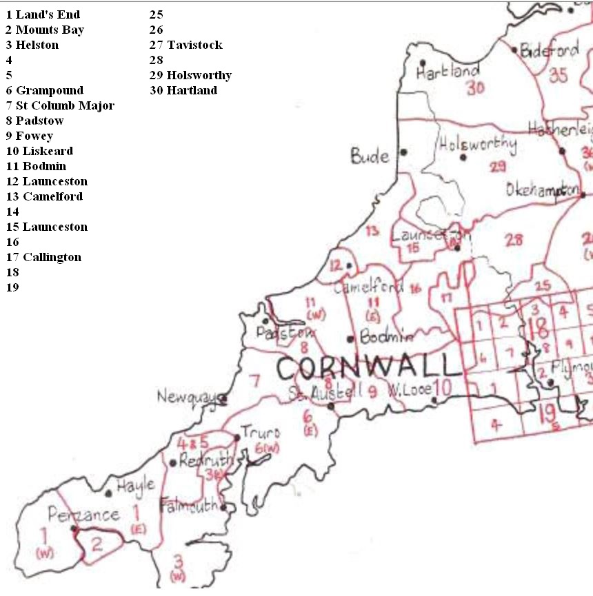
Ordnance Survey Drawing Bodmin
Ordnance Survey Drawing Callington
Ordnance Survey Drawing Camelford
Ordnance Survey Drawing Fowey
Ordnance Survey Drawing Grampound
Ordnance Survey Drawing Hartland
Ordnance Survey Drawing Helston
Ordnance Survey Drawing Holsworthy
Ordnance Survey Drawing Land's End
Ordnance Survey Drawing Launceston 1
Ordnance Survey Drawing Launceston 2
Ordnance Survey Drawing Liskeard
Ordnance Survey Drawing Mounts Bay
Ordnance Survey Drawing Padstow
Ordnance Survey Drawing St Columb Major
Ordnance Survey Drawing Tavistock
ver 26 July 2016