2009 - Grandma Rosie and Anthony went on a trip back east and visted Washington D.C.
proper, our nation's capital. There Antony and Grandma visited a number of places and did a
number of things such as riding to the top of Washington Monument and standing beside a flat
cardboard figure of President Obama (so much for the 'empty chair theory').
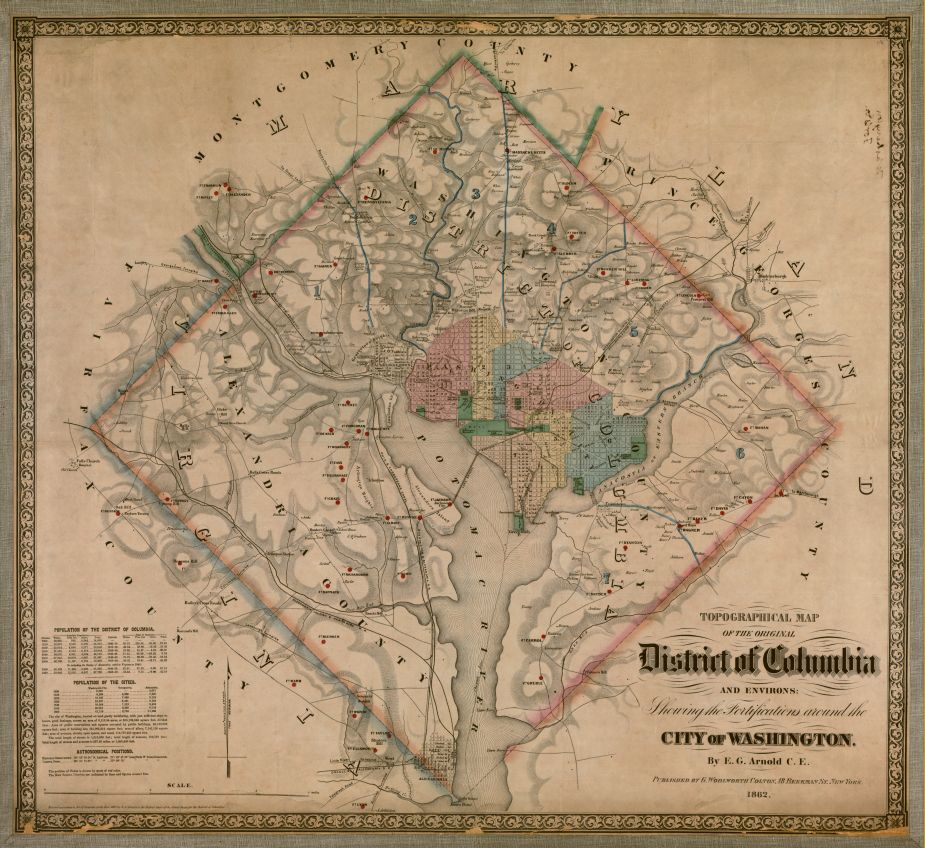
A 1862, Civil War time period, mapping of the District of Columbia and the City of Washington:
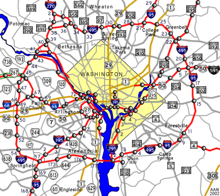
A Long History of the District of Columbia
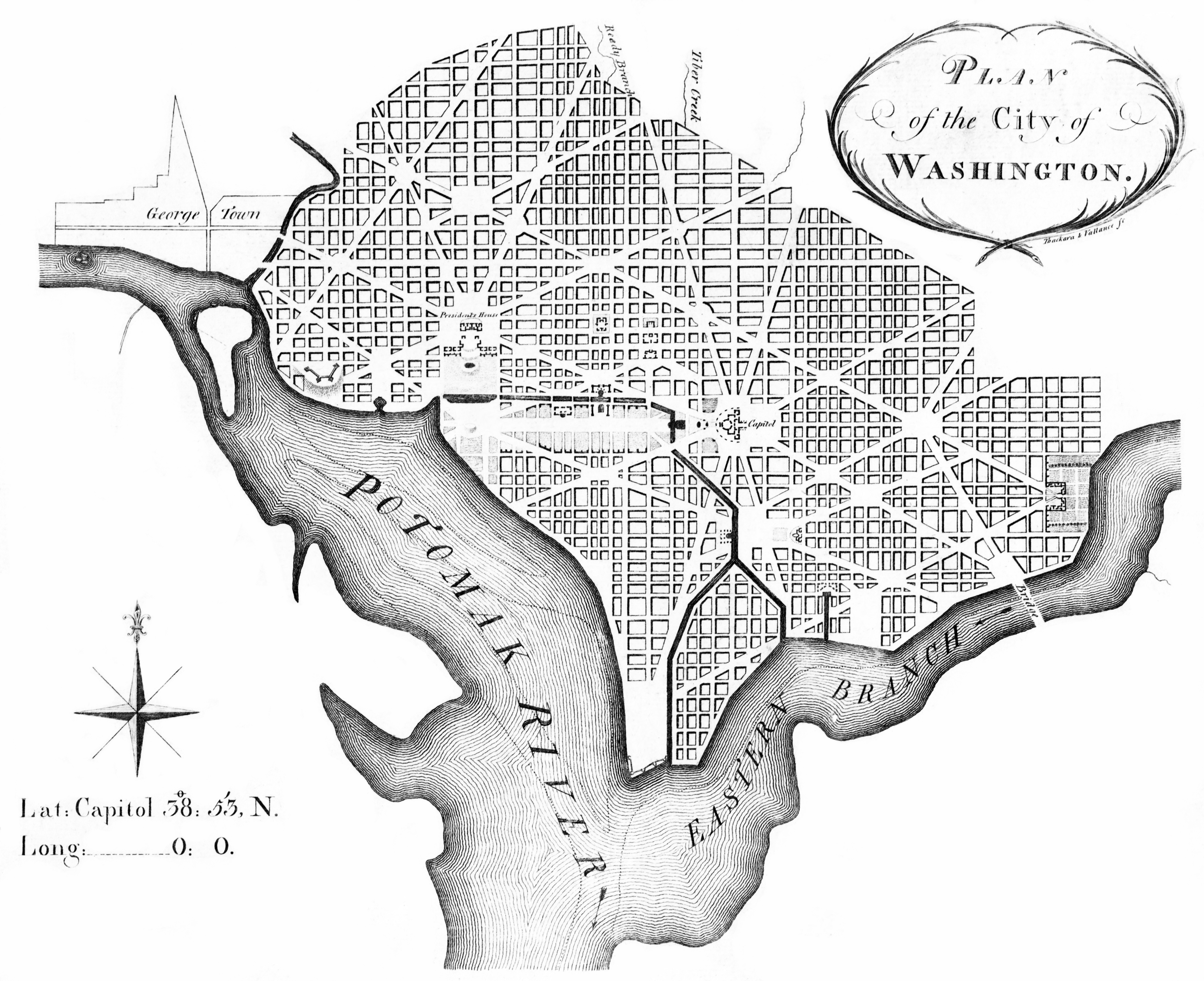
L'Enfant Plan for Washington, D.C., as revised by Andrew Ellicott. Engraved by
Thackara & Vallance sc. Printed from the same plate as map appearing in "The universal asylum,
and Columbian magazine", Philadelphia, March 1792 (the first printed edition of the Plan of the
City of Washington).
A contemporary reprint of Samuel Hill's 1792 print of Ellicott's "Plan of the City
of Washington in the Territory of Columbia", published in "Massachusetts Magazine", Boston, May
1792, showing street names, lot numbers, coordinates and legends.
George Washington was unanimously elected President in 1789 for the then Electoral College
and at his inauguration he took the Oath of Office on April 30, 1789. By 1790 'The Residence
Act of 1790' authorized the President to select the specific location of the permanent seat of
the goverment, which would be located along the Potomac River. After preliminary surveys and
various business, in early 1791, President Washington appointed Pierre (Peter) Charles
L'Enfant to devise a plan for the new city in an area of land at the center of the federal
territory that lay between the northeast shore of the Potomac River and the northwest shore of
the Potomac's Eastern Branch. L'Enfant then designed in his "Plan of the city intended for the
permanent seat of the government of the United States..." the city's first layout, a grid
centered on the United States Capitol, which would stand at the top of a hill (Jenkins Hill)
on a longitude designated as 0:0. The grid filled an area bounded by the Potomac River, the
Eastern Branch (now named the Anacostia River), the base of an escarpment at the Atlantic
Seaboard Fall Line along which a street (initially Boundary Street, now Florida Avenue) would
later travel, and Rock Creek.
North-south and east-west streets formed the grid. Wider diagonal "grand avenues" later named
after the states of the union crossed the grid. Where these "grand avenues" crossed each
other, L'Enfant placed open spaces in circles and plazas that were later named after notable
Americans.
L'Enfant's broadest "grand avenue" was a 400 feet (122 m)-wide garden-lined esplanade, which
he expected to travel for about 1 mile (1.6 km) along an east-west axis in the center of an
area that the National Mall now occupies. A narrower avenue (Pennsylvania Avenue) connected
the "Congress house" (the Capitol) with the "President's house" (the White House). In time,
Pennsylvania Avenue developed into the capital city's present "grand avenue".
L'Enfant's plan included a system of canals, one of which would travel near the western side
of the Capitol at the base of Jenkins Hill. To be filled in part by the waters of Tiber Creek,
the canal system would traverse the center of the city and would enter both the Potomac River
and the Eastern Branch.
On August 19, 1791, L'Enfant presented his plan to President Washington. However, L'Enfant
subsequently entered into a number of conflicts with the three commissioners and others
involved in the enterprise.
During a particularly contentious period in February 1792, Andrew Ellicott informed the
commissioners that L'Enfant had not arranged to have the city plan engraved and had refused to
provide him with an original plan that L'Enfant was then holding. Ellicott, with the aid of his
brother, Benjamin Ellicott, then revised the plan, despite L'Enfant's protests. Ellicott's
revisions realigned and straightened Massachusetts Avenue, eliminated five short radial avenues
and added two others, removed several plazas and straightened the borders of the future
Judiciary Square.
Shortly thereafter, Washington dismissed L'Enfant. Ellicott gave the first version of his
own plan to James Thakara and John Vallance of Philadelphia, who engraved, printed and published
it. This version, printed in March 1792, was the first Washington city plan that received wide
circulation.[50]
After L'Enfant departed, Ellicott continued the city survey in accordance with his revised plan,
several larger and more detailed versions of which were also engraved, published and
distributed. As a result, Ellicott's revisions became the basis for the capital city's future
development.
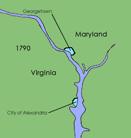
In 1800, the seat of government was finally moved to the new city, and on February 27, 1801,
the District of Columbia Organic Act of 1801 placed the District under the jurisdiction of
Congress. The act also organized the unincorporated territory within the District into two
counties: the County of Washington on the northeast bank of the Potomac, and the County of
Alexandria on the southwest bank. On May 3, 1802, the City of Washington was granted a
municipal government consisting of a mayor appointed by the President of the United States.