
The last geography site names, which we can locate in the Book of Mormon before the time of Christ is the location of the shipping port of Hagoth. In chapter 63 of Alma, a man named Hagoth builds exceedingly large ships of timber and transports people to the land north. Also, according to LDS traditional beliefs and as backed by the work of non-LDS Thor Heyerdahl, the islands of Polynesian in the south seas of he Pacific where populated from the Americas. (See Heyerdahl book 'American Indians in the Pacific.') This port of Hagoth is on the west sea on the border of the land in Bountiful as it borders the land of Desolation on the north. In the time of Mormon, there is a city by the name of Joshua in this same general area. Perhaps Joshua, the last to divide a river to allow the Isrealites to cross over on dry land was the inspiration for the name of this western city where as the Jaredites state the sea did divide the lands. And Perhaps during periods of El Nino, the sea did so and then later dry land would reapear dividing the seas. There is some evidence in the fact that a unique sea creature in habits both the eastern sea shore and the western sea shore of the Darien. And how would it have gotten there but that it was once or a number of times tied together as one sea upon various ocassions. ships.(Alma 63:5-10)
At any rate, Hagoth's shipping becomes a source of clearing much of the forested timber lands of the north lands of Zarahemla which would include the Wilderness lands of Bountiful and Hermounts. One, if not the one, of prime products of this shipping industry to the land north was timber. This was because there was just extremely little or no timber with which to build. Therefore the Nephites shipped vast great quantities of timber from the land of Zarahemla to the land North in order to build 'many large Nephite cities in the land north (Helaman 3:7-11). Now it takes a lot of timber to build 'many cities.' This industry of clearing the land of timber and shipping brought a lot more civilization and people into the land which once was a part of the wilderness of Hermounts and the forested wilderness of Lehi. This was the forest and wilderness which had ehld animals of every kind as taught in both 1 Nephi chapter 18 and Alma chapter 22.
Prior to the 'boomtown' atomosphere Bountiful was just wilderness and one defensive city of Bountiful which Moroni had placed to gaurd the known eastern passage to the land northward, likely the same passage the Mulekites had traveld in comint to the land of Zarahemla from the north upon their first landing and colonization. It is also the beginning of the land of Desolation, since Bountiful's greater land reach upon into the north until it reached and infringed upon the land of Desolation at the likely point of the great city which the Jaredites built there. And that great city of the Jaredites was the city from which expiditions and safaris would set out and bring back the animal and forest goods to the Jaredite civilization.
 Now Bountiful became so populated due to this 'boomtown' industry era, that
the one time defensive city of Bountiful became home to a Temple of God and a
great population center prior to 33AD. And it was to Bountiful that a great
number of people gathered, Zarahemla itself having been burned. And it was
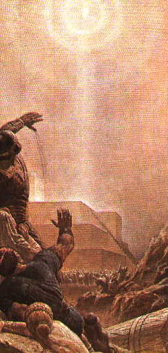
at this site were the people gathered which was visited by Jesus Christ.
And there he blessed the people and ordained the Nephite Apostles, and set
out the order of His Kingdom in the Americas, which would last for nearly 200
years after His coming.
Now Bountiful became so populated due to this 'boomtown' industry era, that
the one time defensive city of Bountiful became home to a Temple of God and a
great population center prior to 33AD. And it was to Bountiful that a great
number of people gathered, Zarahemla itself having been burned. And it was
at this site were the people gathered which was visited by Jesus Christ.
And there he blessed the people and ordained the Nephite Apostles, and set
out the order of His Kingdom in the Americas, which would last for nearly 200
years after His coming.
We have now come full circle from the time of Lehi. You will recall that Lehi's landing site, as stated in 'The Teaching of the Prophet Joseph Smith' on page 267, was just a little south of the Isthmus of Darien. It was Lehi who likely gave the name Bountiful to this very site as it was the place of their first bounteous harvest in the new Promised Land. How ironic it is that the Nephite's path back into the sea from which they came is from the same region, perhaps the same port at which they had entered the land some 530 year before. Perhaps Hagoth was inpired by the stories of Lehi's landing at this region and site to the extend that he was moved to again build an exceeding large ship and set sail from that very port.
Now depending on the season, the currents and trades either favor traveling north along the coastal lands of America or it favors traveling off into the ocean of the South Pacific. It seems that Hagoth's shipping for the most part was able to read the trades and winds correctly and sailed to the land north from this site. And we further have record of a time in which one such party of ships did not sail north but they must have sailed in the season that placed them out into the Pacific from this sailing point. From the land of the sweet potatoe came the Polynesian people which landed and dominated whatever race of people they came across, you may have lived previously in the islands of the South Pacific. Read Heyerdahl's book. His science is of practical experience and factual evidence. It is not the science of the Ivory Tower protecting the 'Sacred Cow Theories' of the academic intellectual cults of the world. And thus such 'theoretical scientists' do mock and scoff at Thor's practical sicence labratory of the real world, in which he uses to prove his statements.
And now you could consider that the map of the land of Zarahemla is nearly complete as to its named sites and major land areas. But this is only true up until the time of the destruction at the death of Christ. And we have only covered a Nephite period of time in the land for the most part from the coming of Mosiah into the Land about 170 BC to about 50 BC. That is only 120 years if we include the land of Hagoth. The reason I mention this, is that many of those who study the Book of Mormon try to make one to one correlations of the cities and lands established in only 120 years, all BC in date, with sites and cites of today. This is even though There has been hundreds and thousands of years expire since this time we have just examined. And this is not even including the catastrophic destructions and changes that occured at the death of Christ in 34 AD all across the face of the land. Yet Book of Mormon geography theorists will begin with Alma 22 of hundreds of years ago and draw one to one conclusions from a highly abridged and ancient record involving many citys of peoples since those dates who have over ran, destroyed and built their own cities, namely the Lamanites.
Having said that, I will attempt to do just what I warned against. That is, I will present a modern map of Colombia and suggest a correlation between the sites shown on it and the sites of the Nephites. I will cheat just a little, because it is a modern map of 'ancient archeaological sites' that have been identified by research and discovery. A few cautions should be exercised in interpreting anything from this map. First, we will be looking at how Colombia is structured and shaped 'today' and not before the time of the great destructions, And even though not all the ancients sites are dated back to Nephite times and cultures but are rather dated back to the later Lamanite occupations, one should remember that often the terain of the land dictates that later civilizations will build where older civilization where previously successful in locating. And the Lamanites hated the Nephites and would have tended to destory everything that was Nephite. Now with these precuations and warnings, lets look at this modern mapping of Colombia in respect to discovered and mapped ancient archeological sites in Colombia at the right. (For a treat, click the map's link.)
Notice how the civilizations to the south west would correlate with the Southwest Defensive Cities Quarter of the land. Notice how Tolima matches with the region of Zarahemla and how Muisca matches the valley of Gideon. And then there are the civilizations in the west Cauca river valley which match those ancient sites shown on the map of Ammonihah and Melek. There is even a site right where the city of Bountiful would be found guarding the way of the eastern shoreline passage through the narrow neck of land. It almost becomes uncanny but for the exceptions. And of course Manti and the regions of San Augustin match at the head waters of the Magdalina River which would correlate with Sidon.
As for the inconsistancy of the sites in northern Colombia, which do not match in location and comparative mapping of the land of Zarahemla, there can be a number of possible explanations, two of which I'll mention. First, as to the shape, one needs only to consider the vast destructions at the time of Christ to account for that. Then as to the sites being populated, much of these sites datings are based on sea shell beds associated with 'civiliation' and Carbon dating of sea shell has been exposed as being highly corrupted by the fact that carbon aging differs vastly in sea water shell life verses the dry land sources. We'll no memtions the Jaredite havesting of the land of the land southward, opps, I just did. And then one could also consider that these sites might be correct, only vastly removed due to the destructions in the land of the collisions of the lands which closed up the Amazon basin and the sea east.